
In the book ’50 Trail Runs in Southern California’, the authors state, “If you can only run two trails in Southern California, one should be the Ray Miller Trail and the other should be the Ray Miller Trail in the opposite direction.” Sadly, part of the loop, the La Jolla Canyon Trail, was damaged in the 2013 Springs Fire and subsequent mudslides. However, the Ray Miller Trail and Overlook Trail are still open and make for a very scenic out and back. This route is also the first, or the last, section of the Backbone Trail, depending on your direction of travel.
Located in Point Mugu State Park, the La Jolla Canyon parking area is on the north side of Pacific Coast Highway. I chose to park on PCH and walk the short distance to the trailhead for two reasons: price and convenience. The cost to park all day is $12, not an unreasonable amount, but I had an appointment after leaving the trail and said rendezvous was more easily kept with my car along PCH.
Traffic was light since leaving Malibu, and I enjoyed a peaceful drive up the coast. A seven am start time provided pleasant temperatures on a quiet Friday morning. The forecast for the upcoming Labor Day weekend was not so promising, and heat advisories were expected.
As I was stretching before hitting the trail, a Sprinter Van pulled up and deposited a number of hikers. There was an identical vehicle parked next to it whose occupants had left just before my arrival. I was able to get started before the second wave of people and began my run.
Not fifty feet in, I stumbled. Luckily I was able to use my hands to keep from face planting and didn’t have so much as a scrape to show for it, but it was a reminder to stay focused on the trail. And what a trail! The Ray is one of the finest I’ve ever had the pleasure of running. During the early part of the day, most of the path is shaded. Being close to the ocean kept the air cooler. The gradient of the route never became too steep, even though you gain roughly a thousand feet in less than three miles. And bikes are not permitted on the Ray.
It had been too many years since I last came this way. It was January of 2016, and I was part of a National Park sponsored traverse of the entire Backbone Trail. The volunteer-led 2016 Backbone Trail adventure consisted of eight hikes going west to east and kindled an understanding and appreciation of the Santa Monica Mountains National Recreation Area. The western part of the Santa Monica’s retain a more remote feeling and remain my favorite part of the range.
It’s slightly less than 3 miles to where the Ray intersects the Overlook trail coming up from Sycamore Canyon. I turn left and kept moving. A younger runner passes me as if I was standing still. Shirtless, carrying no water, he seems to glide effortlessly along the path. Me? I’m wearing a running vest loaded with a couple of water bottles and snacks. I smile, knowing that at my age, I’ll never achieve his level of fitness or percent body fat, and that’s okay, I too am having fun.
Trail running never feels like exercise. Don’t get me wrong, I’m sweating, breathing hard, sometimes even hurting, but it’s not like pounding the pavement. I could expound upon the scenery, being in nature, etc., and it is all that and more. Even though I keep track of my time, I’m not trying to beat my last effort or set a personal best. It’s just a joy to be alive and traipsing through the foothills.
The views are expansive along the Overlook Trail. Boney ridge to the east and the Satellite Tracking Station on Laguna Peak to my left. Mugu peak and the La Jolla valley are visible also. My turn around spot is where the La Jolla Loop trail begins, a stone’s throw past where the Backbone Trail veers right.
Heading back along the Ray is joy, and not just because it’s downhill. The rugged beauty of this part of the California coast stretches out before me. A stumble here, a near trip there reminds me to keep at least one eye on the Ray. Rounding a corner, I stop and pull out my camera, then set off again.
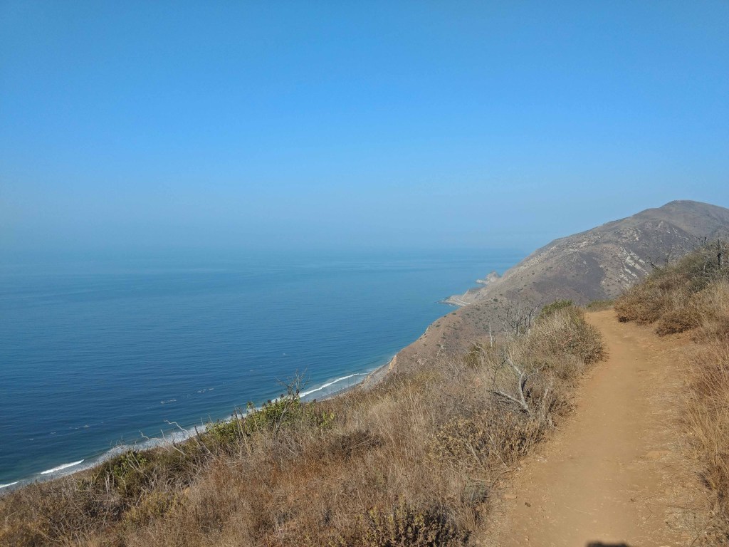 Descending The Ray Miller Trail
People are heading up the trail; I step aside to let them pass. The uphill traveler has the right of way. I make way for another runner on the ascent, this one at least my age and a stone or two heavier. We both wear a knowing grin, a shared understanding that we’ve reached a stage in life where it’s not about how far or how fast; we’re just happy to be able to do this.
Back at the trailhead, I drink some water and start my cool-down routine. I’m feeling good, and then I look down at my legs. Mosquitoes! In less than a minute, I have nearly a dozen bites. Cool-down can wait, I’m out of here!
Out of the park and back at the car, I swap a my ASICS and vest for a towel and flops, then cross the highway. The second reason to park along PCH is to make it easier to keep my appointment with the Pacific. The surfers all have wetsuits, even at the beginning of September. I wade into the surf and wish I had one of those wetsuits, but cooled down I have.
Changing clothes for the commute home, I resolve not to let four more years pass before putting feet on the Ray again.
Here’s information for planning your own visit to the Ray Miller and Overlook Trails:
https://www.alltrails.com/trail/us/california/ray-miller-backbone-trail-to-overlook-trail
